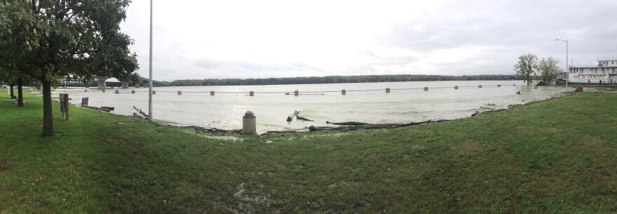
The Mississippi River continues to rise, affecting homes, businesses, and local governments in southeast Iowa, northeast Missouri, and western Illinois. And the latest projections show that it could be several weeks before the flood waters recede.
The website for the National Weather Service tracks river levels and estimated crests
As of 1:00 p.m. on Wednesday, Oct. 10 – River Levels:
- Gladstone - 15.57’ (1.57’ above major flood stage)
- Burlington - 19.97’ (1.97’ above major flood stage)
- Keokuk - 20.13’ (1.13’ above major flood stage)
- Gregory Landing - 21.07’ (3.07’ above moderate flood stage)
- Canton, Mo. - 19.72’ (0.28’ below moderate flood stage)
As of 1:00 p.m. on Wednesday, Oct. 10 – Estimated Crest (Duration):
- Gladstone – Monday, Oct. 15 – 1:00 a.m. (48 hours at crest level)
- Burlington – Monday, Oct. 15 - 1:00 a.m. (48 hours at crest level)
- Keokuk – Monday, Oct. 15 - 7:00 p.m. (30 hours at crest level)
- Gregory Landing – Monday, Oct. 15 – 1:00 p.m. (48+ hours at crest level)
- Canton, Mo. – Monday, Oct. 15 – 7:00 a.m. (18 hours at crest level)

Brian Pierce is a meteorologist with the National Weather Service, based in the Quad Cities. He said people tend to expect flooding during the spring and summer months so the current flooding is a bit unusual.
“Generally, fall is considered the driest time of the year,” said Pierce. “It is considered the start of the water year, when river levels are usually at their lowest. This is a little unusual, but not unheard of.”
Pierce attributes the October flooding along the Mississippi River to moisture from tropical storms traveling north combining with an extremely wet weather pattern in Minnesota, Wisconsin, and northern Iowa.

“The problem is the ground is already saturated and really cannot take any more water," Pierce said. "So any heavy rain they get up there is going to run down immediately into the area rivers and eventually work its way into the Mississippi River.”
Pierce said it will take days for the excess rain to make its way through the tri states region. He said that’s why the river is not projected to crest until early next week in this area.
Pierce said similar instances of delayed crests took place in 1993 and 2008, when flooding devastated the region. But he does not believe this flooding episode is on the scale of those events.
“Part of the reason is that when the rain has come down, it is hitting different areas at different times,” said Pierce. “In 1993 and 2008, rain was more or less pretty consistent happening in the same areas and then on a couple of occasions, you had heavy rain occurring ahead of the crest as it was moving down certain rivers in eastern Iowa, which added to the height of the flooding that occurred.
Local governments and state agencies have been preparing for the flooding:
- Warsaw has closed Water Road, which runs along the river
- The Missouri Department of Transportation has closed Highway 61 in Clark County & a portion of Highway 61 north of Canton, Mo.
- Keokuk plans to close Victory Park and Mississippi Drive if necessary
- Burlington has installed flood barricades to work in conjunction with the city’s new floodwall
- Fort Madison plans to close several streets as the water rises. It has already shut off power to Riverview Park and anticipates sandbagging stations at several city buildings.


